TASHKENT METRO MAP
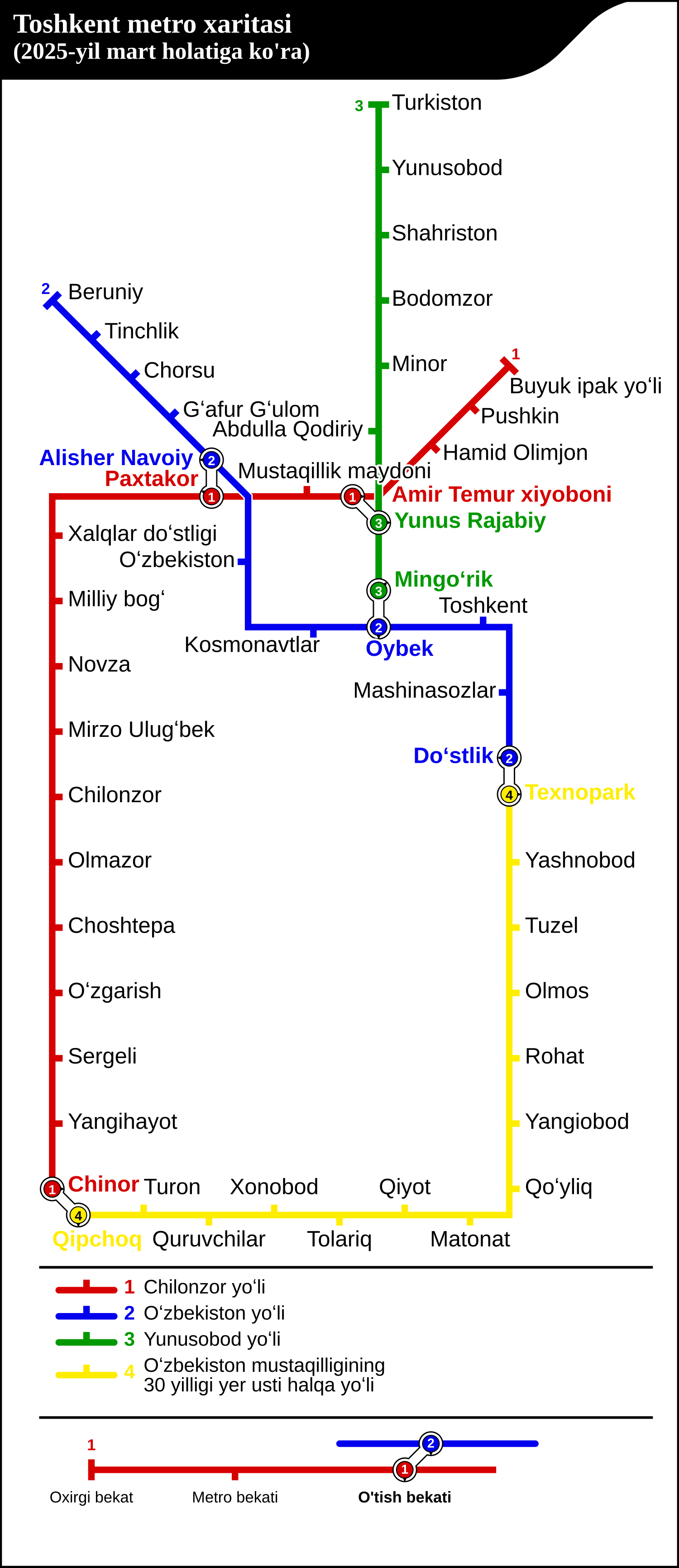
The full map of the Tashkent Metro — all four lines and 50 stations across the capital of Uzbekistan.
4Lines
50Stations
4Interchanges
70.4 kmNetwork length
Map of the Tashkent Metro
The map below shows the whole network — the Chilonzor Line, Oʻzbekiston Line, Yunusobod Line and Circle Line. You can download it as a PDF to keep or print.
The four lines
Tap a line to see all of its stations and route.
Line 1Chilonzor LineBuyuk Ipak Yoʻli → Chinor17 stations · 23.7 km · opened 1977View the Line 1 →Line 2Oʻzbekiston LineBeruniy → Doʻstlik11 stations · 14.3 km · opened 1984View the Line 2 →Line 3Yunusobod LineTurkiston → Mingoʻrik8 stations · 10.5 km · opened 2001View the Line 3 →Line 4Circle LineTexnopark → Qipchoq14 stations · 21.9 km · opened 2020View the Line 4 →
Interchange stations
Where you can change between lines. Tashkent’s interchanges are pairs of separately named stations linked by a connecting passage:
Amir Temur Xiyoboni ↔ Yunus Rajabiy
Chilonzor Line to Yunusobod Line — a 3-minute walk.
Alisher Navoiy ↔ Paxtakor
Oʻzbekiston Line to Chilonzor Line — a 3-minute walk.
Mingoʻrik ↔ Oybek
Yunusobod Line to Oʻzbekiston Line — a 3-minute walk.
Doʻstlik ↔ Texnopark
Oʻzbekiston Line to Circle Line — a 4-minute walk.